与「GoogleEarth」相关的搜索结果
GoogleEarth 贴吧
一个关键词就是一个贴吧,路径全站唯一。
用户
未找到
包含 GoogleEarth 的内容

以前想在电脑上开着飞机环游世界、鸟瞰地表,还得专门去下载安装好几个 GB 的谷歌地球专业桌面版,甚至要忍受复杂的配置?赶紧把那些笨重臃肿的桌面客户端连夜送进碎纸机! ⚰️
谷歌官方终于整了个超级大活!最硬核、最让人上瘾的 谷歌地球飞行模拟器(Google Earth Flight Simulator),现已直接在网页端向全球用户无门槛全量开放!无需下载任何插件,打开浏览器就能狂暴起飞!
✈️ 网页端一键御风起飞
⛰️ 硬核地貌“海拔剖面图”
📂 全新专业级导入类型
纯净、免费,网页端的流畅度直接拉向外太空。想要足不出户、零门槛体验全屏开飞机的老哥们,机长广播已响起,赶紧复制网址准备起飞👇(不会操作,无法调出飞行模拟器的看下图箭头指示)
🔗 网页端起飞直达:
#谷歌地球# #飞行模拟器# #GoogleEarth# #黑科技# #网页神站# #极客必备# #环游世界# #免安装#
显示更多


During the ongoing Ebola outbreak in the Democratic Republic of Congo (DRC), our partners at @WHOAFRO put Google Earth AI to work to uncover transmission blind spots faster.
They used our Geospatial Reasoning agent prototype to map areas where exposure risk and human mobility are high. In minutes, the team pinpointed 48 exposed settlements and located more than 45,500 at-risk people — a process that normally would have taken weeks.
显示更多

Google Earth AI can bridge critical gaps across diverse geographies, diseases, and areas of public health using autonomous predictions and population dynamics.
The system combines environmental signals and other data sources with AlphaEarth Foundations and our Population Dynamics Foundation Model (PDFM), and a prototype Geospatial Reasoning agent.
In plain language, researchers ask questions like where a disease is likely to spread next, and the AI automatically gathers relevant models and datasets to build an accurate prediction model.
By combining satellite views with population patterns, the tool reveals hidden risk factors, helping identify issues earlier.
显示更多

Forecasting where a disease outbreak might spread usually requires weeks of stitching together fragmented satellite imagery, census tables, and local health records.
Now, new research shows how Google Earth AI can help communities address public health crises more quickly and proactively.
By combining insights beyond simple statistics — like behavioral trends, geospatial AI models, and more — public health teams can better understand complex public health issues, bridge reporting gaps, and shift emergency response from reactive management to proactive prevention.
显示更多
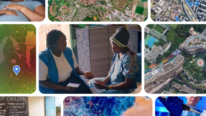

Google is doing some great AI work in India that is actually helping farmers on the ground and honestly, almost nobody is talking about it.
It’s surprising how much we focus on every new model drop, while some of the most meaningful AI work is happening quietly in the real world.
Google DeepMind’s AnthroKrishi team built two AI models using satellite imagery:
- Agricultural Landscape Understanding (ALU) maps farm boundaries, trees and water bodies, with historical data going back 15 years.
- Agricultural Monitoring & Event Detection (AMED) uses multispectral data to monitor crops, sowing and harvesting, identifying 11 major crops.
And this is already being used at scale:
- 5M+ farmers in Telangana through its agricultural DPI
- 140M+ hectares covered by Terrastack
- 2.6M hectares of irrigated land in Karnataka
- CarbonFarm is using it across 12 countries
- FAO is integrating the models into its global agricultural data platform with $2.5M from Google
These models are now providing agricultural insights across 6 African countries, and the Agricultural Landscape Understanding layer is one of the most popular layers on Google Earth globally.
显示更多


Google Earth now lets you create AI images using real-world locations.
With the new Nano Banana AI feature, you can pick any place in Google Earth, click “Create Image,” and describe what you want to see.
The AI can turn that location into a historical scene, a futuristic city or a fantasy world
The feature uses Google Earth’s satellite and 3D map data as the base, so the AI-generated images are built from real locations.
显示更多


最近试了试GPT 5.6 Sol,用它从零复刻了三个3D数字世界:可交互的人脑模拟器、香港城市实时数据地图、类Google Earth数字地球。我本人完全不懂3D开发,全靠截图+自然语言描述,大家看看效果怎么样。
显示更多


Claude just became a craacked video game designer.
With the launch of Unreal Engine's MCP server last week, you can now build entire video games just by talking to Claude.
I spent the past few days building with it, and I'm telling you, this is going to forever change how video games get made and who gets to make them.
In this video I show you exactly how to set up the Unreal Engine MCP yourself and run through three demos: building a full playable city, cloning a real city from Google Earth, and creating custom buildings in Blender.
Here's the agent harness I mention too:
Intro
What I built in a few hours
Setting up the Unreal MCP server
Fixing the port 8000 connection issue
The agent harness that avoids the pitfalls
Demo 1: Building a city with City Sample
Demo 2: Cloning a real city from Google Earth with Cesium
Demo 3: Custom buildings with Blender headless
Outro
显示更多

Google has added its flight simulator to the web version of Google Earth, making it available to all users worldwide.
>The feature runs directly in any modern browser at with no downloads or installations required.
>Users can open the simulator from the Tools menu after selecting Explore and pilot a virtual aircraft over detailed 3D terrain, buildings, and satellite imagery across the entire planet.
>It uses simplified flight physics designed for casual exploration and works with standard mouse and keyboard controls.
显示更多


谷歌真是绝了,又出了个有趣的东西:
- Google Earth 飞行模拟器 -
你可以在Google 地图上的任意地方自由飞行,全程模拟飞机驾驶感
现已在网页端全球向所有用户开放,
飞行体验:
显示更多
